 INSPIRE-1
Keyword
Geoscientific information
62 record(s)
Provided by
Type of resources
Available actions
Topics
Keywords
Contact for the resource
Update frequencies
-
The map of the soil depth gives an overview of the rooting capacity of German soils. The soil depth is derived from profile data of the landuse stratified soil map of Germany at scale 1:1,000,000. The lower limit of a soil is bedrock or a groundwater influenced horizon. The method is derived from Bodenkundliche Kartieranleitung KA5 (2005) and is documented in the MethodenWIKI of the FISBo BGR. The land use information is derived from the CORINE Land Cover data set (2006).
-
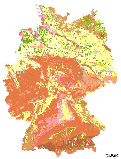
The presented map at scale 1:5,000,000 shows the distribution of 15 soil parent material groups in Germany with polygons of at least 64 square kilometers. Parent material is the rock, from which soil is formed. It was derived from the landuse use stratified soil map of Germany at scale 1:1,000,000. The version 3.0 of the map is based on the Digital Landscape Model 1:1,000,000 (DLM1000) of the Federal Agency for Cartography and Geodesy.
-
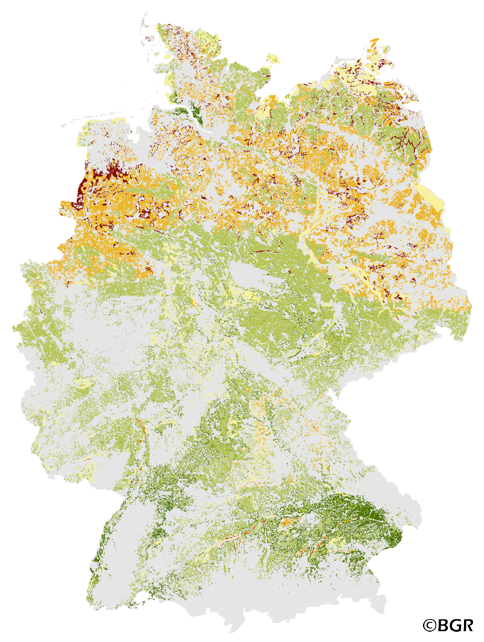
The Potential Wind Erosion Risk map gives an overview of the exposure of arable soils to soil loss due to deflation in Germany. It is based on pedological and climatic factors. The method to predict the soil erosion risk is published in the DIN 19706:2002 and in the documentation of Ad-hoc-AG Boden (representing the soil experts of the geological services of the German federal states). For the application with soil maps, the method was adapted by the Federal Institute for Geosciences and Natural Resources (BGR).The land use stratified soil map of Germany at scale 1:1,000,000 was used as pedological input to the model. The mean annual wind speed at 10 meters above ground level of the period 1980-2000 (DWD) is used as well. The land use information is derived from CORINE land cover data set (2006).
-
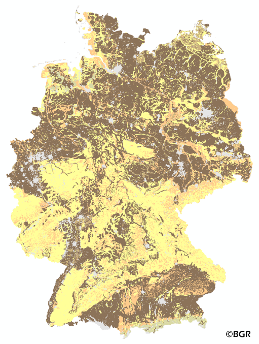
The BUEK5000 is derived form the landuse stratified soil map of Germany at scale 1:1,000,000 by aggregation, focused on information about the parent material, and generalization. The maps shows 20 soil (23) legend units with polygons of at least 64 square kilometers.
-
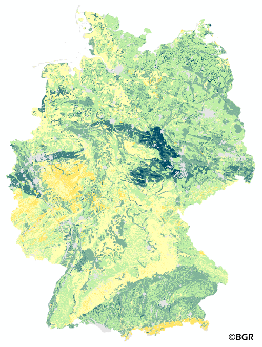
The map of the available water holding capacity in Germany gives an overview of the amount of water in a soil that is normally available for plant growth. The map shows the available water from the surface to effective rooting depth, which is derived from land use and soli data. The method is published in the Bodenkundliche Kartieranleitung KA4 (1994) and in the documentation of Ad-hoc-AG Boden (representing the soil experts of the geological services of the German federal states). The land use information is taken from the CORINE Land Cover data set (2006).
-
The map shows the distribution of typical soil types (soil texture) in the topsoils of Germany. Typical is used in the term of areally dominating. The map visualizes the results of the project that are documented in a BGR report (Bodenarten der Böden Deutschlands; BGR Archiv, Nr. 0127305). The soil texture data from the analysis of the particle size distribution for 16,132 sites in Germany were classified after the legend units of land use-stratified soil map of Germany 1: 1,000,000 (BÜK1000N V2.3) and mean soil texture were calculated. Considering the large heterogeneity in the data and the resulting uncertaintly in the precision for a site the depiction of the obtained soil texture is presented at the level of the soil types group, according to the German soil classification system (KA5).
-
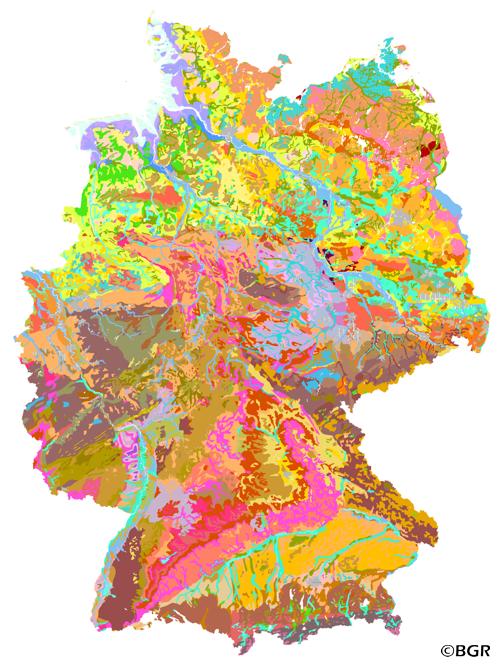
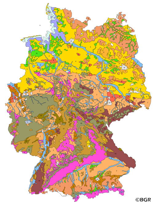
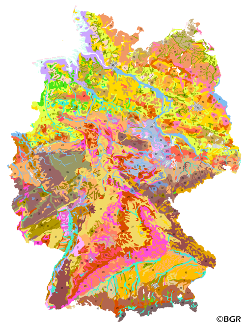
The first country wide soil map at a scale of 1:1,000,000 (BUEK1000) has been compiled on the basis of published soil maps of the former German Democratic Republic and the pre 1990 federal states of Germany. To do this, it was necessary to match the soil systems used in East and West Germany and to develop standardized descriptions of soil units. A relatively homogeneous map has resulted, which permits uniform assessment of the soils throughout Germany. The map shows 71 soil mapping units, described in the legend on the basis of the German and FAO soil systems. Each soil unit has been assigned a characteristic soil profile (Leitprofil) as an aid to map interpretation. For the first time the subdivision of the country into 12 soil regions has been represented on the map. This subdivision was coordinated with the state Geological Surveys. These soil regions will represent the highest hierarchic level of nation wide soil maps in future. The colours of soil units correspond to the standards of the 'Bodenkundliche Kartieranleitung' (KA 3; Guidelines for Soil Mapping). The various hues characterize differences in relief or soil humidity. The BUEK1000 was produced digitally. It is an important part of the spatial database integrated in the Soil Information System currently being established at the Federal Institute for Geosciences and Natural Resources (FISBo BGR). It can be used together with the characteristic soil profiles to derive thematic maps related to nation wide soil protection. The scale of the BUEK1000 makes it especially suitable for small scale evaluations at federal or EU level.
-
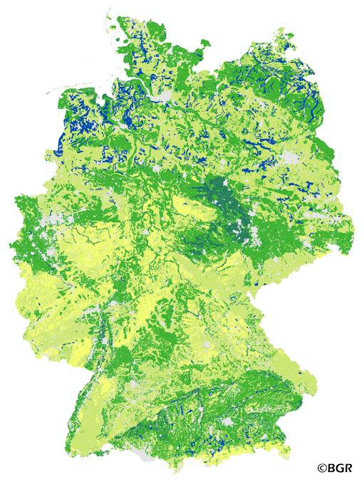
The map of the field capacity of soils in Germany gives an overview of the amount of water which can be stored in a soil (depth 1 m). The water storage capacity is a key function of soils. The field capacity was derived from the landuse stratified soil map of Germany at scale 1:1,000,000. The method is published in the Bodenkundliche Kartieranleitung KA4 (1994) and in the documentation of Ad-hoc-AG Boden (representing the soil experts of the geological services of the German federal states). The land use information is derived from the CORINE Land Cover data set (2006).
-
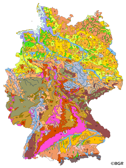
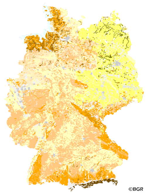
The BUEK3000 is prepared by the Federal Institute for Geosciences and Natural Resources (BGR) for the National Atlas of Germany. Based on the generalized and aggregated soil map 1:2,000,000, it shows 43 mapping units with information about soil texture, parent material, dominant and associated soils.
-
The map Organic Matter Content of Top-Soils in Germany 1:1,000,000 highlights the results of a Germany-wide compilation of typical soil organic matter contents in top-soils differentiated according to 15 groups of soil parent material, four climatic areas and the main land use. The evaluation is based on more than 9000 soil data profiles with information about Soil Organic Matter (SOM) from a period of about 20 years. The report 'The Organic Matter Content of Top-Soils in Germany', BGR Archiv, No. 0127036 (in German) documents the methodology. The classes of the map legend are based on the classes given in the German Soil Mapping Guideline, 5th Edition (KA5).